
Project Summary
The Sacramento / San Joaquin Delta is the hub of California's water delivery system and serves over 20 million people in Southern California. It is composed of "islands" circumscribed by approximately 1100 miles of levees that constantly impound water, preventing flooding of the islands. Peaty organic soils that comprise much of the Delta have oxidized and blown away over the past 150 years, resulting in rapid subsidence. Many islands are now 3 to 5 meters below sea level.
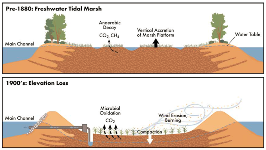
Subsidence Process (Mount and Twiss 2005)
The levees are composed of uncompacted loose dredged soils that are saturated, and are therefore susceptible to liquefaction. The Delta lies on the eastern margin of the San Andreas fault system in a zone with moderate seismic hazard.

Seismic Hazard in the Delta (DWR: Delta Risk Management Study 2009)
Recent projections indicate that a Delta earthquake could result in widespread levee failures and the simultaneous inundation of multiple islands. Such an event would locally reverse the flow direction in the Delta, causing the intrusion of saline water from the west that would contaminate the water supply and halt water delivery for a period of years. The Delta earthquake scenario is one of the most important hazards facing the United States because the consequences of such an event would be unimaginably catastrophic. In 2004 a single levee breach in the Upper Jones Tract cost over $200 million in total losses. It took three weeks to repair the breach and five months to de-water the island. In 2009 a study from the Department of Water Resource estimated that a moderate earthquake in the Delta could disrupt the fresh water delivery system for 20 to 30 months in result in around $40 billion in economic losses.
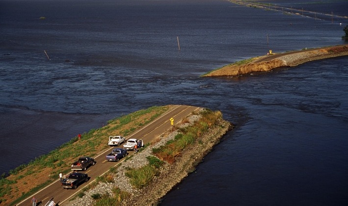
Failure of the Upper Jones Tract (2004)
The research objective of this project is to investigate the deformation potential of liquefiable levees supported on peaty organic soils through centrifuge testing. Two large scale 9 m radius centrifuge tests (named “RCK01” and “RCK02”) were conducted at the NEES@UCDavis experimental facility on heavily instrumented models. A series of 11 small scale 1 m radius Schaevitz centrifuge tests were preliminarily conducted in order to estimate the response of the models during testing in the large scale tests.
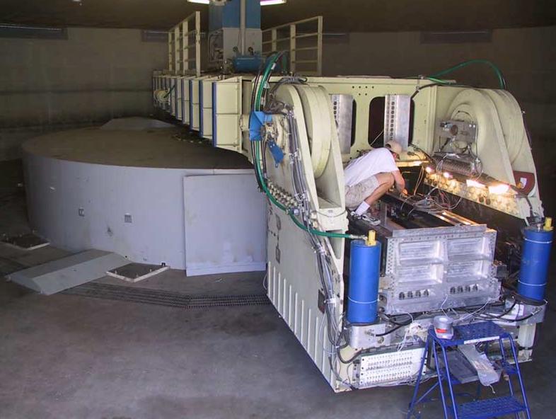
Large centrifuge (9 m radius) at the NEES@UCDavis experimental facility
Each 9 m radius test consisted of two phases. First, a levee built with modeling clay was placed on top of a peat layer. Several ground motions were applied in order to study the interaction between soft peat and stiffer levee fills, and gain insight into the volume change behavior of organic soils under cyclic loading.
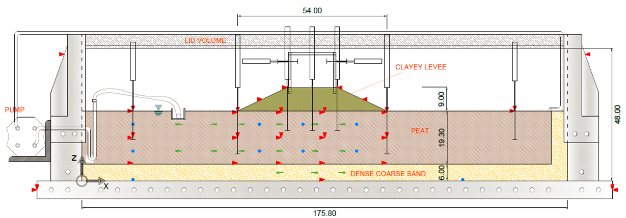
Schematic view of the first phase with a clayey levee
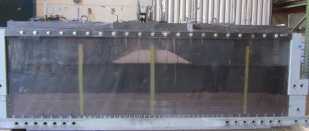
Sideview of the model before going on the arm
Secondly, the clayey levee was removed and replaced with a saturated sandy levee. The levee was then subjected to a target ground motion representative of the seismic risk in the Delta to study deformation potential of saturated sandy levees resting on peat due to liquefaction of the levee fill. A complex pumping system was installed to simulate the levee retaining on water on side.
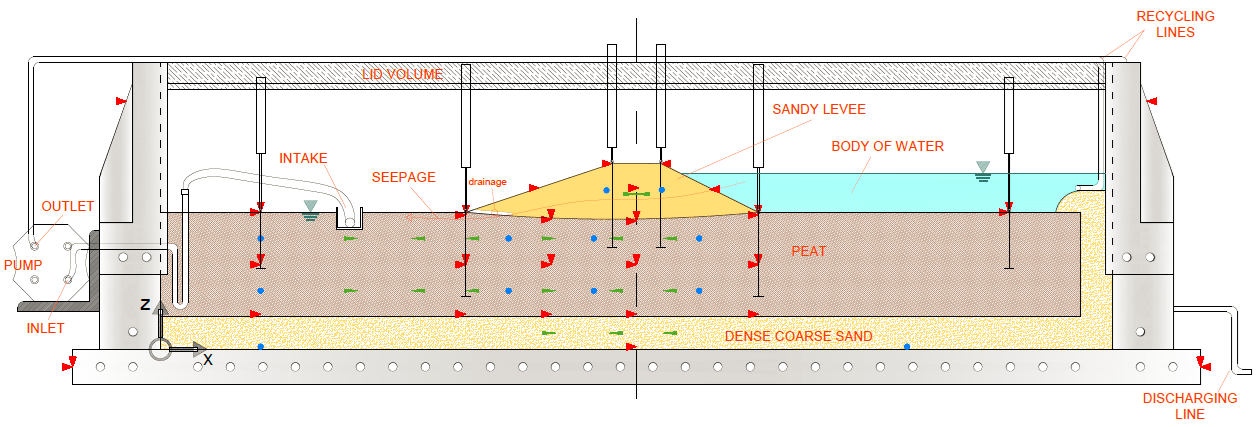
Schematic view of the second phase with a sandy levee and standing water on one side
The peat thickness in the second large scale investigation was varied in order to study its influence on system response. For more information about centrifuge testing, please visit the website of the UC Davis Center for Geotechnical Modeling.